![](/images/other/stat-length.png)
![Tocht Te voet Žďár nad Sázavou - Naučná stezka Babín - Photo](https://media.geolcdn.com/t/1900/400/e4d7c6a2-63c1-4793-a32a-764e3ceb4c67.jpeg&format=pjpeg&maxdim=2)
Naučná stezka Babín
SityTrail - itinéraires balisés pédestres
Tous les sentiers balisés d’Europe GUIDE+
![Lengte](/images/other/stat-length.png)
Lengte
4,2 km
![Max. hoogte](https://static1.geolcdn.com/siteimages/upload/files/1508320355ic_sort_altitude_max_24dp.png)
Max. hoogte
607 m
![Positief hoogteverschil](https://static1.geolcdn.com/siteimages/upload/files/1508320355ic_sort_den_pos_24dp.png)
Positief hoogteverschil
85 m
![Km-Effort](/images/other/stat-length.png)
Km-Effort
5,4 km
![Min. hoogte](https://static1.geolcdn.com/siteimages/upload/files/1508320355ic_sort_altitude_min_24dp.png)
Min. hoogte
555 m
![Negatief hoogteverschil](https://static1.geolcdn.com/siteimages/upload/files/1508320355ic_sort_den_neg_24dp.png)
Negatief hoogteverschil
92 m
![Boucle](https://static1.geolcdn.com/siteimages/upload/files/16400158638029165_repeat_loop_refresh_sync_direction_icon.png)
Boucle
Neen
Markering
Datum van aanmaak :
2025-02-07 18:02:54.615
Laatste wijziging :
2025-02-07 18:02:54.615
![Te voet](https://static1.geolcdn.com/sitytour/trail-icons/100.png)
1h13
Moeilijkheid : Gemakkelijk
![Scan deze QR-code om de tocht te openen in de SityTrail-applicatie](https://capi.geolives.com/qq0zvz2zws4bq2lad0pu/sitytour/trails/4346458/qr.png?size=200)
Gratisgps-wandelapplicatie
Over ons
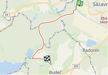
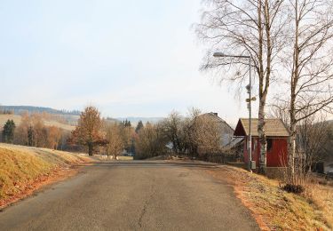
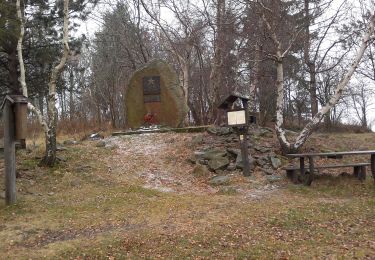
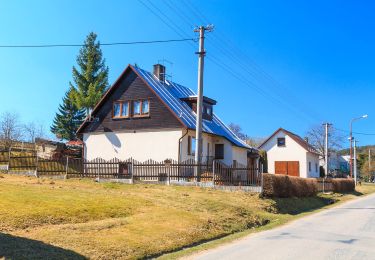
Tocht Te voet van 4,2 km beschikbaar op Zuidoost, Kraj Vysočina, Žďár nad Sázavou. Deze tocht wordt voorgesteld door SityTrail - itinéraires balisés pédestres.
Beschrijving
Tocht aangemaakt door Správa CHKO Žďárské vrchy.
Plaatsbepaling
Land:
Czech Republic
Regio :
Zuidoost
Departement/Provincie :
Kraj Vysočina
Gemeente :
Žďár nad Sázavou
Locatie:
Unknown
Vertrek:(Dec)
Vertrek:(UTM)
566816 ; 5490080 (33U) N.
Opmerkingen
Wandeltochten in de omgeving
![Tocht Te voet Bobrová - NS Okolím Bobrové (červená) - Photo](https://media.geolcdn.com/t/375/260/0e24b115-55b2-4400-bed8-93552e7e2f99.jpeg&format=jpg&maxdim=2)
![Te voet Te voet](https://static1.geolcdn.com/sitytour/trail-icons/100.png)
NS Okolím Bobrové (červená)
Te voet
Gemakkelijk
Bobrová,
Zuidoost,
Kraj Vysočina,
Czech Republic
![](/images/other/stat-length.png)
6,1 km | 8,3 km-effort
1h 52min
![](https://static1.geolcdn.com/siteimages/upload/files/16400158638029165_repeat_loop_refresh_sync_direction_icon.png)
Ja
![Tocht Te voet Chotěboř - NS Údolím Doubravy - Photo](https://media.geolcdn.com/t/375/260/4dc93202-c333-4714-8d7d-1a2e78f24388.jpeg&format=jpg&maxdim=2)
![Te voet Te voet](https://static1.geolcdn.com/sitytour/trail-icons/100.png)
NS Údolím Doubravy
Te voet
Gemakkelijk
Chotěboř,
Zuidoost,
Kraj Vysočina,
Czech Republic
![](/images/other/stat-length.png)
3,5 km | 4 km-effort
54min
![](https://static1.geolcdn.com/siteimages/upload/files/16400158638029165_repeat_loop_refresh_sync_direction_icon.png)
Neen
![Tocht Te voet Sobíňov - [Z] Sobíňov - okruh - Photo](https://media.geolcdn.com/t/375/260/6e3bc23c-a605-4b4d-8770-baba1e84eab9.jpeg&format=jpg&maxdim=2)
![Te voet Te voet](https://static1.geolcdn.com/sitytour/trail-icons/100.png)
[Z] Sobíňov - okruh
Te voet
Gemakkelijk
Sobíňov,
Zuidoost,
Kraj Vysočina,
Czech Republic
![](/images/other/stat-length.png)
5,8 km | 7 km-effort
1h 36min
![](https://static1.geolcdn.com/siteimages/upload/files/16400158638029165_repeat_loop_refresh_sync_direction_icon.png)
Ja
![Tocht Te voet Sobíňov - NS Sobíňov - Photo](https://media.geolcdn.com/t/375/260/6e3bc23c-a605-4b4d-8770-baba1e84eab9.jpeg&format=jpg&maxdim=2)
![Te voet Te voet](https://static1.geolcdn.com/sitytour/trail-icons/100.png)
NS Sobíňov
Te voet
Gemakkelijk
Sobíňov,
Zuidoost,
Kraj Vysočina,
Czech Republic
![](/images/other/stat-length.png)
5,8 km | 7 km-effort
1h 36min
![](https://static1.geolcdn.com/siteimages/upload/files/16400158638029165_repeat_loop_refresh_sync_direction_icon.png)
Ja
![Tocht Te voet Křižánky - Příběh krajiny pod Čtyřmi palicemi - Photo](https://media.geolcdn.com/t/375/260/afe50164-5347-4821-bfa6-7f0f6ff30948.jpeg&format=jpg&maxdim=2)
![Te voet Te voet](https://static1.geolcdn.com/sitytour/trail-icons/100.png)
Příběh krajiny pod Čtyřmi palicemi
Te voet
Gemakkelijk
Křižánky,
Zuidoost,
Kraj Vysočina,
Czech Republic
![](/images/other/stat-length.png)
4,5 km | 5,7 km-effort
1h 17min
![](https://static1.geolcdn.com/siteimages/upload/files/16400158638029165_repeat_loop_refresh_sync_direction_icon.png)
Ja
![Tocht Te voet Nové Město na Moravě - [M] Ochoza - okruh, local - Photo](https://media.geolcdn.com/t/375/260/dce1f716-3160-4704-a566-a47335ab040b.jpeg&format=jpg&maxdim=2)
![Te voet Te voet](https://static1.geolcdn.com/sitytour/trail-icons/100.png)
[M] Ochoza - okruh, local
Te voet
Gemakkelijk
Nové Město na Moravě,
Zuidoost,
Kraj Vysočina,
Czech Republic
![](/images/other/stat-length.png)
10,5 km | 15 km-effort
3h 25min
![](https://static1.geolcdn.com/siteimages/upload/files/16400158638029165_repeat_loop_refresh_sync_direction_icon.png)
Ja
![Tocht Te voet Nové Město na Moravě - [Č] Nové Město - Maršovice, local - Photo](https://media.geolcdn.com/t/375/260/31abdc5d-2493-41c4-881a-742b6a91a848.jpeg&format=jpg&maxdim=2)
![Te voet Te voet](https://static1.geolcdn.com/sitytour/trail-icons/100.png)
[Č] Nové Město - Maršovice, local
Te voet
Medium
Nové Město na Moravě,
Zuidoost,
Kraj Vysočina,
Czech Republic
![](/images/other/stat-length.png)
18 km | 23 km-effort
5h 19min
![](https://static1.geolcdn.com/siteimages/upload/files/16400158638029165_repeat_loop_refresh_sync_direction_icon.png)
Ja
![Tocht Te voet Věcov - Naučná stezka Metodka - Photo](https://media.geolcdn.com/t/375/260/992490b9-69b5-47f8-9951-50652ed6ca6a.jpeg&format=jpg&maxdim=2)
![Te voet Te voet](https://static1.geolcdn.com/sitytour/trail-icons/100.png)
Naučná stezka Metodka
Te voet
Gemakkelijk
Věcov,
Zuidoost,
Kraj Vysočina,
Czech Republic
![](/images/other/stat-length.png)
3,7 km | 4,4 km-effort
1h 0min
![](https://static1.geolcdn.com/siteimages/upload/files/16400158638029165_repeat_loop_refresh_sync_direction_icon.png)
Ja
![Tocht Te voet Oldřiš - CZ-4299 - Photo](https://media.geolcdn.com/t/375/260/f5a5045c-0299-4e5f-8166-343ca95529ab.jpeg&format=jpg&maxdim=2)
![Te voet Te voet](https://static1.geolcdn.com/sitytour/trail-icons/100.png)
CZ-4299
Te voet
Gemakkelijk
Oldřiš,
Noordoost,
Pardubický kraj,
Czech Republic
![](/images/other/stat-length.png)
3,5 km | 5,2 km-effort
1h 11min
![](https://static1.geolcdn.com/siteimages/upload/files/16400158638029165_repeat_loop_refresh_sync_direction_icon.png)
Neen